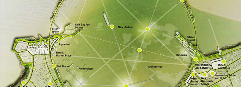
Alexandria Port :-
Port ID Number (ISPS Code)
14726
Acceptance date
17/6/2004
Time Zone
GMT +2
VHF
10 11 13 14 67
ISPS Code Source

Coordinate
Long
29 o 52 / E
Lat
31 o 11 / N
Natural Characteristics
Weather
Prevailing winds are North West.
Water Density
1.030 g/cm3
Raining Season
winter
Tidal range and flow
0.46m.
Port Description :-
Location
Alexandria is situated on the West Verge of the Nile Delta between the Mediterranean Sea and Mariut Lake. It is considered the second most important city and the main port in Egypt. It handles over three quarters of Egypt’s foreign trade. Alexandria port consists of two harbours (East and West) separated by a T-shaped peninsula. The East harbour is shallow and is not used in navigation. The West harbour is used for commercial shipping. The harbour is formed by two converging breakwaters.
Geographical Overview
The First Zone
It extends from maritime force borders up to gate number 2 customs. It consists of many maritime quays starting from quay 1 up to quay 14/16.
The Second Zone
Is situated between berths 16 and 28 deals with 4 types of activities: unified cargoes including Ro Ro, passengers' terminal, stuffed bulk cargoes, and barge discharge.
The Third Zone
It is located between berth 35 and the end of the military berth 47. New buildings were established after the development. The type of handled cargo in this area is general cargo.
The Fourth Zone
Is located between berths 49 and 68, and is used for handling containers, cement, coal, barge discharge, fertilizers, and general cargo.
The Fifth Zone
The borders of this area extend from gate no.36 customs with petroleum dock border incluiding maritime berths from zone 71(a) and 85/2, and is used for handling: molasses, timber, some types of general cargoes, barge discharge, grains and flour.
The Sixth Zone (Oil Dock)
is situated at the western boundaries of the port, encompasses oil berths 87/1, 2, 3, 4, 5, and is used for handling edible oil, oil products and for providing bunkers. It also includes berth 86 situated at the port’s limits, used for handling livestock. The ports does not include oil storage facilities, but oil berths are connected to a refinery through a 2 km. long pipeline.
Port Berths :-
Total quay notes according to their types
Berth Type
Nu
Auxiliary Berths
Length (m.)
Depth (m.)
From
From
To
General Cargo
30
05/1-5/2
05/3-5/4
09-10-11
12-13-14
25-26-27
02-35-36
37-38-39
40-41-42
43-44-56
65-66-67
82-85/02
05/3-5/4
09-10-11
12-13-14
25-26-27
02-35-36
37-38-39
40-41-42
43-44-56
65-66-67
82-85/02
3533.2
5.5
10.7
Passenger & Tourist Terminal
5
16-18-
20-22
24 m
20-22
24 m
801
9.7
11.3
RORO
1
25/26 m
30.5
9.1
9.1
Military
2
46- 47
324.9
9.4
9.4
Container Terminal
4
49-51
53-54
53-54
548.6
12.8
12.8
New Container Terminal
2
72-73
365.8
11.8
11.8
Molasses
1
71 m
-
10
10
Provisions and Grains Terminal
3
84-85
85 /1
85 /1
691.9
9.7
12.8
Coal Terminal
4
61-62
63-64
63-64
426.7
8.5
12.8
Livestock
1
86
m
130.7
7.9
7.9
Edible oil & petroleum terminal
5
87/1-87/2
87/3-87/4
87/5 m
87/3-87/4
87/5 m
771.8
10
10.4
Scrap Berth
1
55
m
-
10
10
Total
59
7625.1
